Symbols of Peace
Peace Boulevard
Peace Boulevard, which runs East to West in the center of Hiroshima City was planned as a disaster-prevention road measuring 3,570 meters in length, connecting Tsurumi-cho and Fukushima-cho. With a width of 100 meters, this road is also called "100 meter wide road." As a site where building demolition work had been implemented as an air defense measure from the end of 1944, it was integrated into the post-war urban planning project.
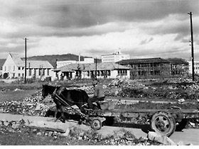
Horse cart moving along uncleared Peace Boulevard
1949
Ko-machi
View looking northwest from Ko-machi. The building demolition site where the rubble is piled up was the starting point of the land-clearing operation of Peace Boulevard. In the background of the horse cart are the Hiroshima Civil Information & Education Information Center and Hiroshima Music High School, both of which are under construction. The triangular roof at the left end is Hiroshima Baptist Church. |
 |
 |
|
|
|
 |
|
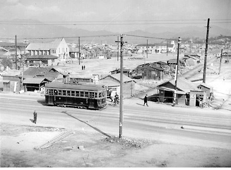
Peace Boulevard under land-clearing operation
1950
Onomichi-cho (now, Ote-machi 3-chome)
View looking east from the intersection of Peace Boulevard and Rijo Dori. Compared to the photo on the left, the area stretching from Ko-machi to Shimo-naka-machi (now, Naka-machi) had been significantly cleared, except for some shacks at the middle of the boulevard.
|
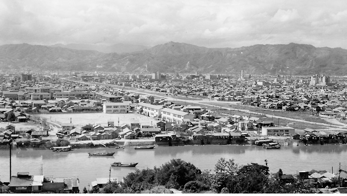
Commanding view of Peace Boulevard
1954 Hijiyama Park
Commanding view of Peace Boulevard of an area stretching east to west from Hijiyama Hill through Hiroshima City. Although paving work had already begun by then, completion all along the boulevard to Koi, the west end, had to wait until 1965. In contrast to the well-ordered boulevard, shacks remain on the banks of the Kyobashigawa River.
|